
Must-Visit Stops On The Blue Ridge Parkway In North Carolina
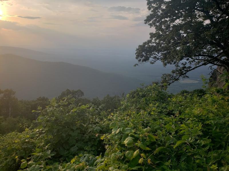
Here in western North Carolina, one of the most scenic ribbons of road in America runs right through our backyard. The Blue Ridge Parkway stretches 469 miles through Virginia and North Carolina, with hundreds of trailheads, scenic overlooks, picnic areas, visitor centers and other attractions along the way. There’s simply no other road like it.
Explore the Blue Ridge Parkway in Western NC
The southern endpoint of the Blue Ridge Parkway is just an hour from our doorstep here in Cashiers, North Carolina. If you’re looking for one place to see some of the most spectacular scenery in the Appalachian Mountains, then the parkway is the place for you.
The Blue Ridge Parkway has mileposts all along the way to make it easy to keep your bearings and find any landmarks you might be looking for. There are truly too many destinations to even think about visiting them all, but we’re excited to share some of our favorites.
Southern Terminus (Milepost 469.1)
The beginning of the Blue Ridge Parkway (technically the endpoint) is located just off US-441 near Cherokee. This is also the location of the Oconaluftee Visitor Center, which is a gateway to Great Smoky Mountains National Park and a popular spot for elk viewing. If you’re not in too much of a hurry to start driving, take a few moments to stroll along the Oconaluftee River Trail.
Southern Terminus
Blue Rdg Pkwy,
Cherokee, NC 28719
828-670-1924
www.blueridgeparkway.org

Waterrock Knob (Milepost 451.2)
Known for being one of the best places to watch the sunset on the Blue Ridge parkway, the Waterrock Knob Overlook has some truly spectacular scenery. At an elevation of 5,820 feet, this location features the highest-elevation visitors center on the parkway, and it’s also a prime picnic site. For an even better view, take the short-but-strenuous 0.6-mile Waterrock Knob trail to the 6,273-foot summit of Waterrock Knob.
Waterrock Knob
Sylva, NC 28779
828-775-0975
Richland Balsam (Milepost 431.4)
The Richland Balsam Overlook is notable for being the highest point on the Blue Ridge Parkway. Perched at 6,053 feet above sea level, this overlook offers a sweeping view, and it also marks the trailhead for the Richland Balsam Trail. The trail ascends a further 400 feet to the actual summit of Richland Balsam, the highest mountain in the Great Balsam range, and it’s a relatively easy 1.3-mile round-trip loop hike.
Richland Balsam
Milepost 431, Blue Ridge Parkway
Black Balsam Knob (Milepost 420.2)
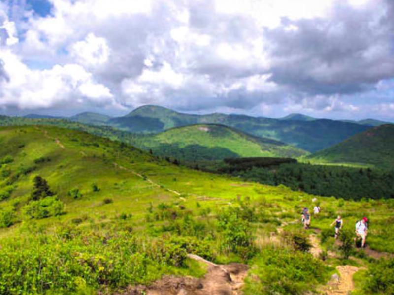
If you’re looking for a beginner-friendly and kid-friendly hike just off the Blue Ridge Parkway, then Black Balsam Knob is definitely a great place to stop. A short (1.4 miles round-trip) hike on a section of the Art Loeb Trail will take you to the open summit of Black Balsam Knob, a grassy, meadow-like mountaintop that provides a panoramic view and is frequently adorned in blooming wildflowers from spring through summer.
Black Balsam Knob
Milepost 420.2, Blue Ridge Parkway
Cold Mountain Overlook (Milepost 411.9)
One of 40 North Carolina summits over 6,000 feet, Cold Mountain is an iconic peak that became even more famous as the inspiration for Charles Frazier’s novel Cold Mountain and the Academy-award winning film of the same name. The Cold Mountain Overlook on the Blue Ridge Parkway squarely faces the mountain and provides a great view of the Shining Rock Wilderness.
Cold Mountain Overlook
Wagon Road Gap, Hwy 276 at Milepost 411.9,
Blue Ridge Parkway
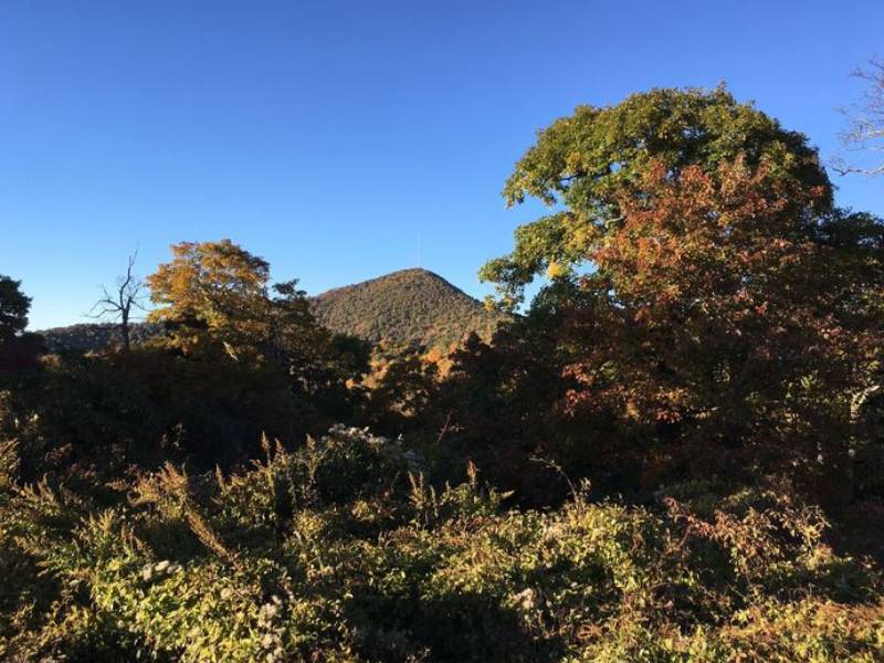
Mount Pisgah (Milepost 407.8)
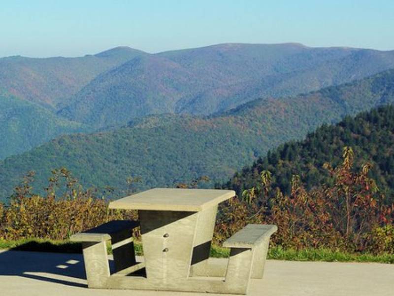
At 5,721 feet, Mount Pisgah isn’t the tallest peak on the Blue Ridge Parkway, but it is a spectacular mountain that offers some truly exceptional scenery. It’s particularly stunning in fall. The parkway’s Mount Pisgah Overlook includes an on-site restaurant and gift shop, as well as a picnic area, campground and trailheads that provide access to many miles of hiking trails, including the 1.6-mile ascent to Mount Pisgah’s Summit.
Mount Pisgah
Milepost 407.8, Blue Ridge Parkway
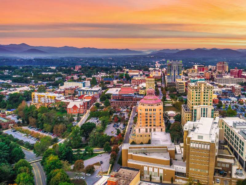
Asheville, NC (Milepost 382)
The Blue Ridge Parkway skirts the east side of Asheville, and the city offers a great opportunity to stop and enjoy a bite to eat, and perhaps a little culture. In addition to great shopping, dining and live music, Asheville is home to the Southern Highland Craft Guild and Folk Art Center, which is conveniently located right alongside the parkway at milepost 382.
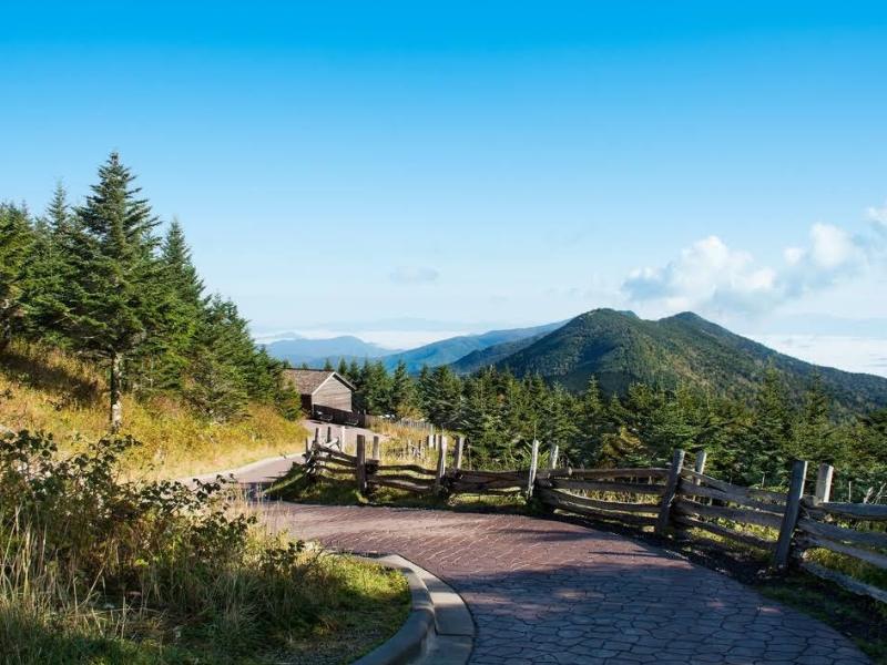
Mount Mitchell State Park (Milepost 355.4)
The 6,684-foot summit of Mount Mitchell is the highest point east of the Mississippi River, making it a real highlight of the Blue Ridle Parkway. You can reach the mountaintop via the short-but-steep Mount Mitchell Summit Trail, which starts at the Eisha Mitchell Historical Marker within Mount Mitchell State Park. To get there, take route 128 north from the parkway at Milepost 355.4. You can also view Mount Mitchell from the Ridge Junction Overlook at Milepost 355.3.
Mount Mitchell State Park
2388 NC-128, Burnsville, NC 28714, United States
828-675-4611
www.ncparks.gov/mount-mitchell-state-park
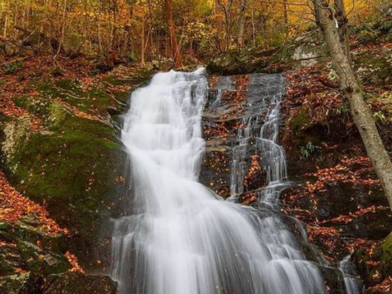
Crabtree Falls (Milepost 339.5)
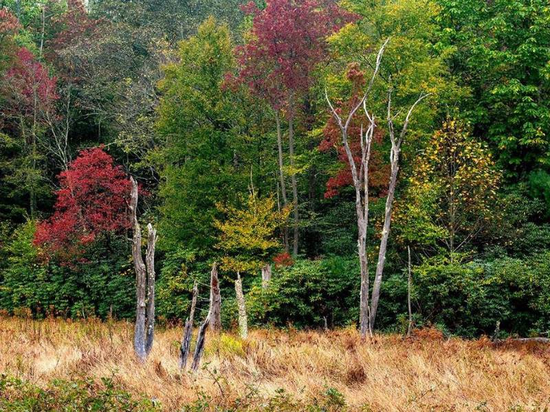
There are dozens of beautiful waterfalls on or near the Blue Ridge Parkway, and you could dedicate a trip entirely to seeing the best ones. Crabtree Falls is certainly worthy of inclusion. Cascading over a craggy 60-foot cliff surrounded by mixed hickory forest, it’s a charming waterfall that is best viewed in spring when water levels are up. Crabtree Falls is accessible via a trail from the Blue Ridge Parkway, and it’s either a 1.8-mile out-and-back hike or a 3-mile loop depending on your route of choice.
Crabtree Falls
39000 Blue Ridge Parkway, Marion, NC 28752
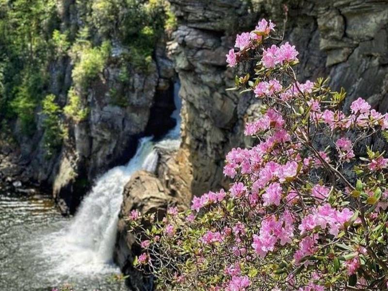
Linville Falls (Milepost 316.3)
If Crabtree Falls doesn’t fully satisfy your waterfall cravings, then you’ll definitely want to check out Linville Falls. One of the most dramatic waterfalls in the Blue Ridge Mountains, Linville Falls tumbles through the rocky Linville Gorge, which has been nicknamed the “Grand Canyon of the East.” Exit the Blue Ridge parkway at Mile Marker 316.3 and head to the Linville Falls Visitor Center, where the 1.6-mile round-trip hike to the falls begins.
Linville Falls
Blue Ridge Mountains, NC
Elevation: 996 m
828-765-6082
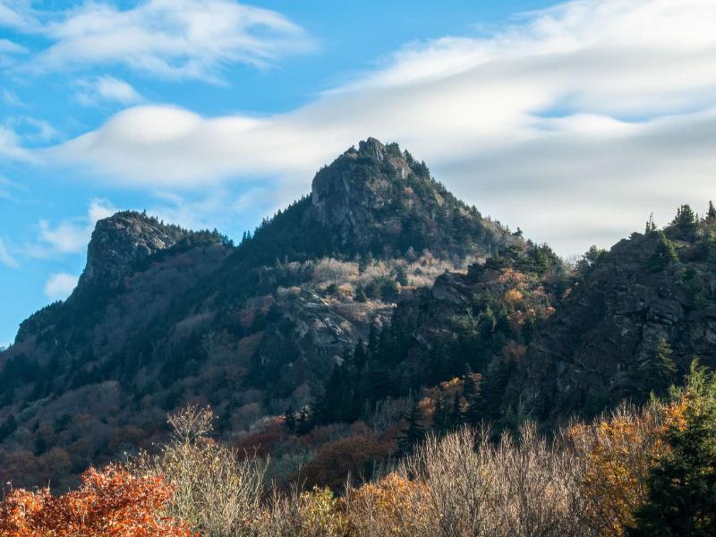
Grandfather Mountain (Milepost 305)
The source of the Linville River and one of North Carolina’s most famous peaks, Grandfather Mountain stands at 5,946 feet, and you can enjoy a dramatic view of its profile from the Grandfather Mountain Overlook on the Blue Ridge Parkway. You’ll have to take a detour off the parkway to visit Grandfather Mountain State Park, (best bet is the “Little Parkway” off Milepost 294.6) which includes the famous Mile High Swinging Bridge and panoramic views from the summit.
Grandfather Mountain
2050 Blowing Rock Highway,
Linville, NC
Elevation: 1,812 m
800-468-7325
www.grandfather.com
Sally Mae’s on the Parkway (Milepost 258.8)
If you’ve driven this far, chances are you’re hungry and in need of a leg-stretch. Sally Mae’s on the Parkway (formerly the Northwest Trading Post) is an official concessioner of the National Park Service, and has been offering food, drinks and souvenirs in this location since the 1950s. It’s a great spot to grab a sandwich and a cold pop before you hit the road again. For more information on the Blue Ridge Parkway, check out the official website courtesy of the National Park Service. And as always, contact us to learn more about staying and playing in the Cashiers, North Carolina area.
Sally Mae’s on the Parkway
414 Trading Post Road
Glendale Springs, NC 28629
336-982-2543